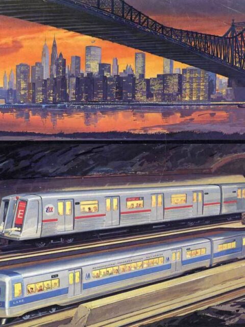
MTA Program for Action Service Guide I recently went down a bit of a rabbit hole reading up… Continue reading “MTA Program for Action Service Guide”…
“Mapping the Underground and Unseen City” talk for the Center for Railroad Photography and Art Last month I was fortunate enough to give a talk about my… Continue reading ““Mapping the Underground and Unseen City” talk for the Center for Railroad Photography and Art”…
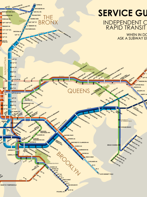
IND Service Guide: 1953 Celebrating an historic cartographer with a fantastical future map from 1953. Continue reading “IND Service Guide: 1953”…
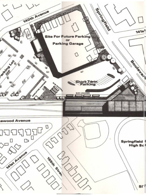
Serving Southeast Queens Part 2 In part one of this series I looked at the long, tortuous… Continue reading “Serving Southeast Queens Part 2”…
A quick look at the MTA’s 2025-2044 20-Year Needs Assessment Early this morning the MTA quietly published the initial outline of their… Continue reading “A quick look at the MTA’s 2025-2044 20-Year Needs Assessment”…
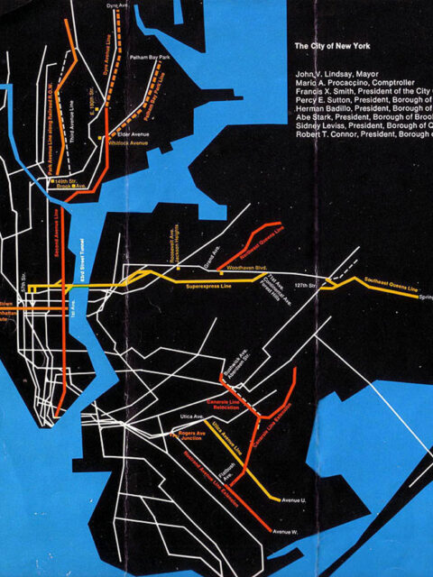
Serving Southeast Queens Part 1: The Forgotten Route 131 In the annals of NYC subway history there are numerous examples of… Continue reading “Serving Southeast Queens Part 1: The Forgotten Route 131”…
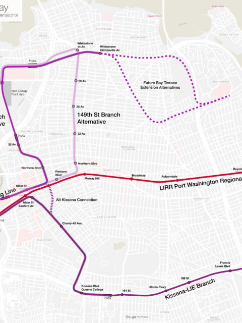
Much ado about Flushing: Regional Rail and Extending the 7 Train A holistic proposal to enhance and expand transit into Flushing, Queens. This post was written with the Tech Transit Assn. Continue reading “Much ado about Flushing: Regional Rail and Extending the 7 Train”…
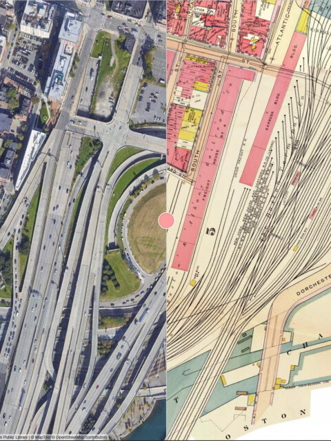
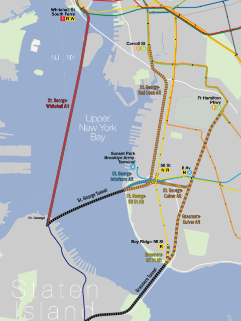
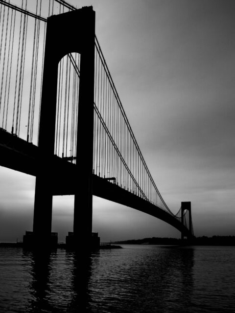
A Tunnel Too Far, Part 2: Hylan’s Dream In the previous post I outlined the history of the many plans… Continue reading “A Tunnel Too Far, Part 2: Hylan’s Dream”…
A Tunnel Too Far, Part 1: Staten Island’s Failed Pipe Dream The first in a two-part post about the history and possible future of a subway tunnel to Staten Island. Continue reading “A Tunnel Too Far, Part 1: Staten Island’s Failed Pipe Dream”…
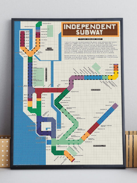
IND Tile Color Map A unique way to visualize the NYC subway using color theory. Continue reading “IND Tile Color Map”…
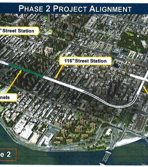
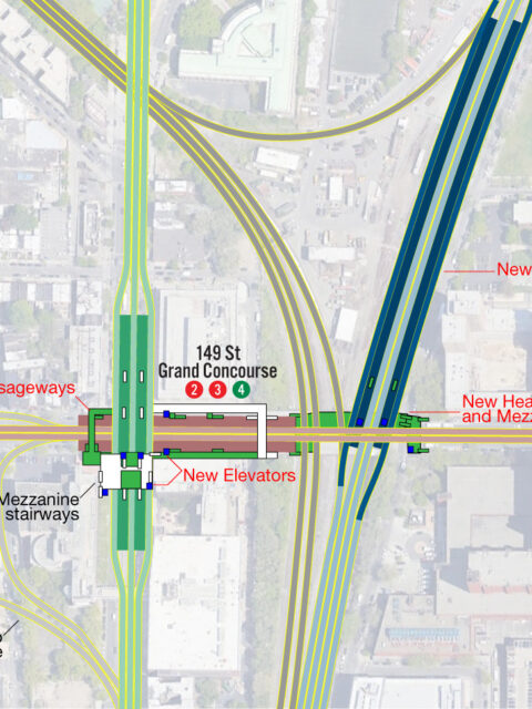
Second Avenue Subway Phase 2: The case for a crosstown extension on 125th Street Guest Author: Kristian Laverick When it was originally conceived in the 1920’s,… Continue reading “Second Avenue Subway Phase 2: The case for a crosstown extension on 125th Street”…
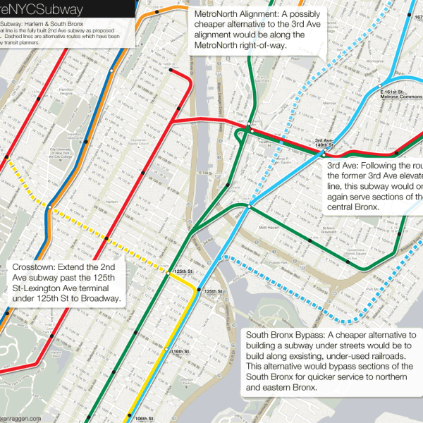
The Future of the 2nd Ave Subway: A Bronx Tail Track Do we really need to extend the 2nd Ave Subway into the Bronx? Continue reading “The Future of the 2nd Ave Subway: A Bronx Tail Track”…
 vanshnookenraggenvanshnookenraggen