The Devolution of the IND Second System The idea for this post came from an overlooked appendix at the… Continue reading “The Devolution of the IND Second System”…
The Last Train to Jamaica: How NYC Almost Replaced Its Els The New York City subway is famously made up of three formerly… Continue reading “The Last Train to Jamaica: How NYC Almost Replaced Its Els”…
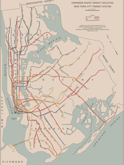
The Lost 1943 IND Second System Plan Students of NYC subway history know this map. It is one of… Continue reading “The Lost 1943 IND Second System Plan”…
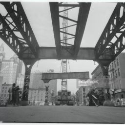
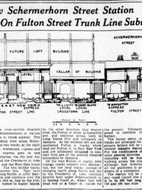
End of the Line: The Unfinished Fulton St Subway When Duke Ellington wrote “Take the A Train” he wasn’t talking about… Continue reading “End of the Line: The Unfinished Fulton St Subway”…
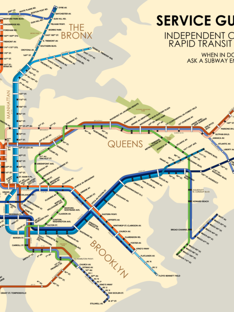
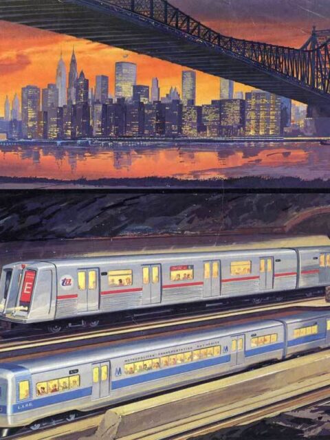
IND Service Guide: 1953 Celebrating an historic cartographer with a fantastical future map from 1953. Continue reading “IND Service Guide: 1953”…
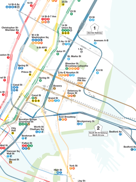
Serving Southeast Queens Part 1: The Forgotten Route 131 In the annals of NYC subway history there are numerous examples of… Continue reading “Serving Southeast Queens Part 1: The Forgotten Route 131”…
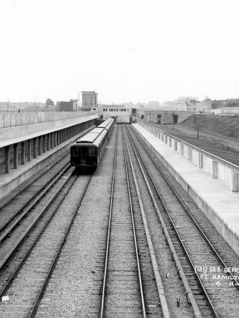
Mysteries of the BMT Sea Beach Express If you take the N train to Coney Island you might notice that there are a pair of unused tracks down the center of the line. No one is quite sure why they exist. Continue reading “Mysteries of the BMT Sea Beach Express”…
IND Second System Track Map A detailed look at every official subway expansion proposal from 1929 until the present. Continue reading “IND Second System Track Map”…
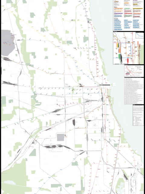
Chicago: Complete and Geographically Accurate Track Map I am incredibly excited to release my newest map: The Complete and… Continue reading “Chicago: Complete and Geographically Accurate Track Map”…
Boston MBTA: Complete and Geographically Accurate Track Map Large format prints are available at my vanmaps.com store. I was more… Continue reading “Boston MBTA: Complete and Geographically Accurate Track Map”…
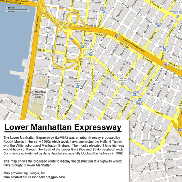
Unbuilt Highways of New York City and Robert Moses Few people loom as large in the annals of New York City… Continue reading “Unbuilt Highways of New York City and Robert Moses”…
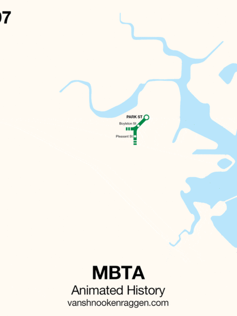
An Animated History of the MBTA [UPDATE: This map was originally published in 2009. Since then, the MBTA… Continue reading “An Animated History of the MBTA”…
 vanshnookenraggen