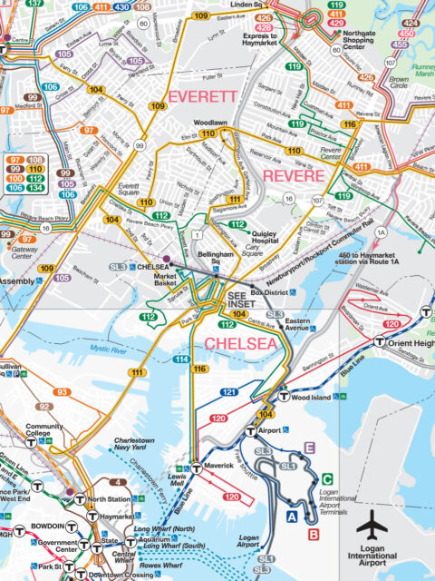
(T Don’t Want To Go To) Chelsea “Where is Chelsea’s subway station?” A blog post last year by the… Continue reading “(T Don’t Want To Go To) Chelsea”…
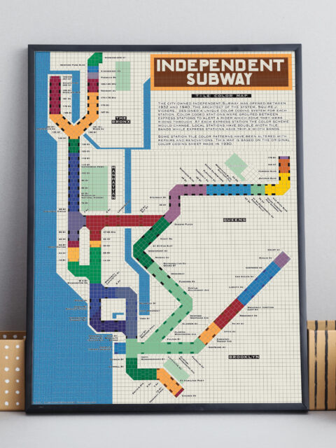
IND Tile Color Map A unique way to visualize the NYC subway using color theory. Continue reading “IND Tile Color Map”…
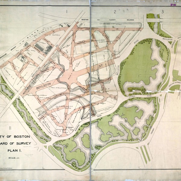
Boston Historic “T” Track Map A detailed look at ever official plan to expand the T since 1897. Continue reading “Boston Historic “T” Track Map”…
Updated NYC and Boston Track Maps I’m happy to announce a new version of the New York City… Continue reading “Updated NYC and Boston Track Maps”…
The Future of the Green Line: From Harvard and Needham to the Seaport Boston’s subway is straining with new growth. It is time to rethink America’s oldest subway for the 21st Century. Continue reading “The Future of the Green Line: From Harvard and Needham to the Seaport”…
Build Transit Where It’s Most Effective, Not Where It’s Least Expensive Transit planners often look for the path of least resistance but this more often than not reduces the effectiveness of transit. Transit should be built where it will be most effective not where it’s cheapest to build. Continue reading “Build Transit Where It’s Most Effective, Not Where It’s Least Expensive”…
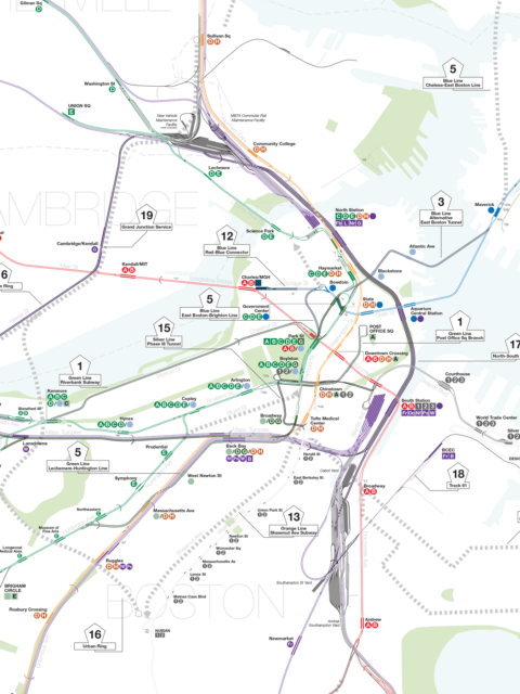
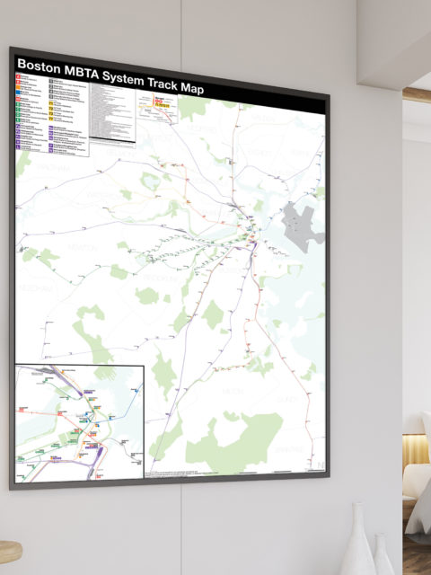
Boston MBTA: Complete and Geographically Accurate Track Map Large format prints are available at my vanmaps.com store. I was more… Continue reading “Boston MBTA: Complete and Geographically Accurate Track Map”…
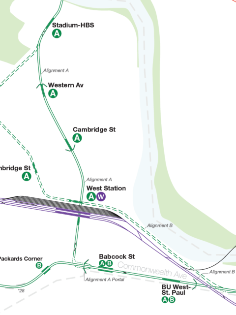
Thoughts on the Blue Line Back Bay Bypass I’ve been making maps of fantasy subway extensions for a decade now.… Continue reading “Thoughts on the Blue Line Back Bay Bypass”…
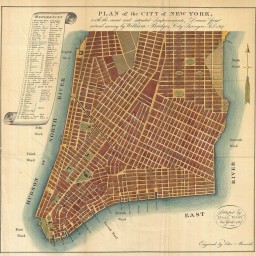
Gramercy Before Gramercy, 1807 vs 2013 To even the most seasoned New Yorker the city south of 14th… Continue reading “Gramercy Before Gramercy, 1807 vs 2013”…
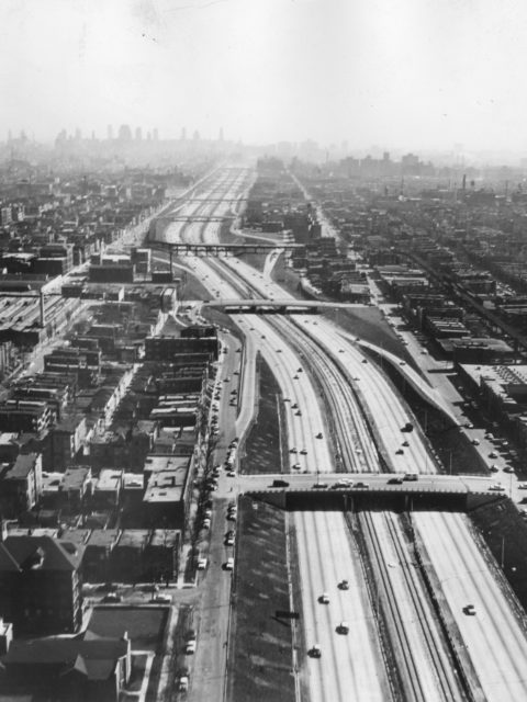
The Death and Life of an Elevated Subway Continue reading “The Death and Life of an Elevated Subway”…
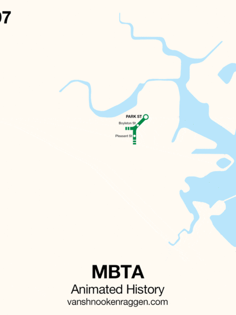
An Animated History of the MBTA [UPDATE: This map was originally published in 2009. Since then, the MBTA… Continue reading “An Animated History of the MBTA”…
Unbuilt Street Grid of West Fenway Map Reproduction Courtesy of the Norman B. Leventhal Map Center at the… Continue reading “Unbuilt Street Grid of West Fenway”…
 vanshnookenraggen