


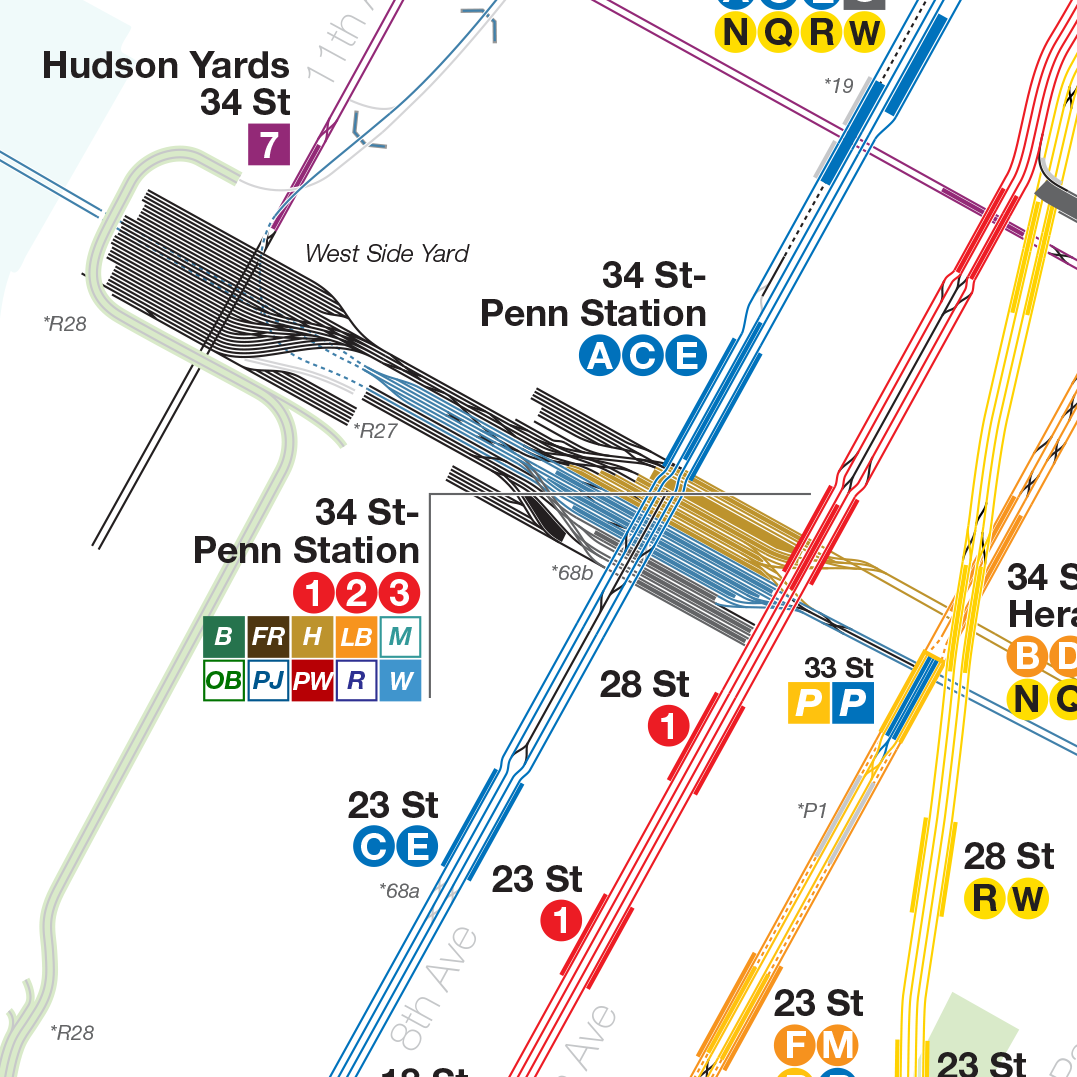
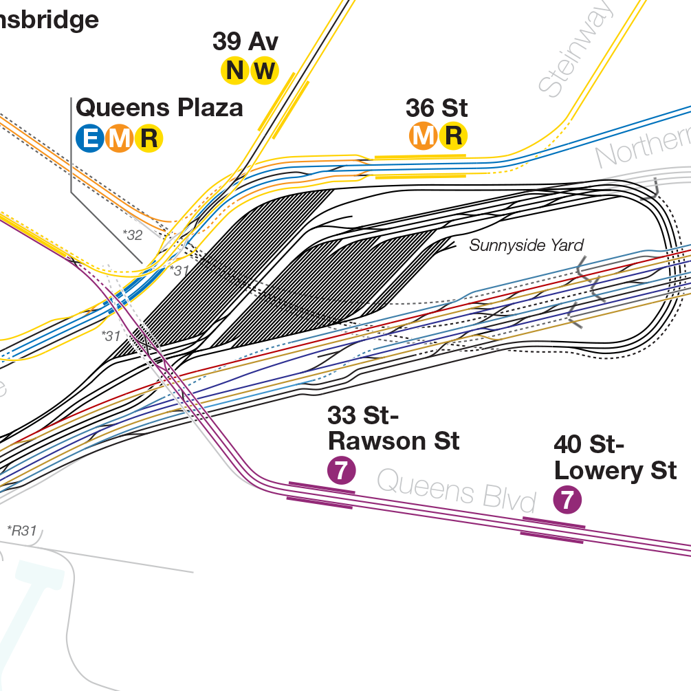
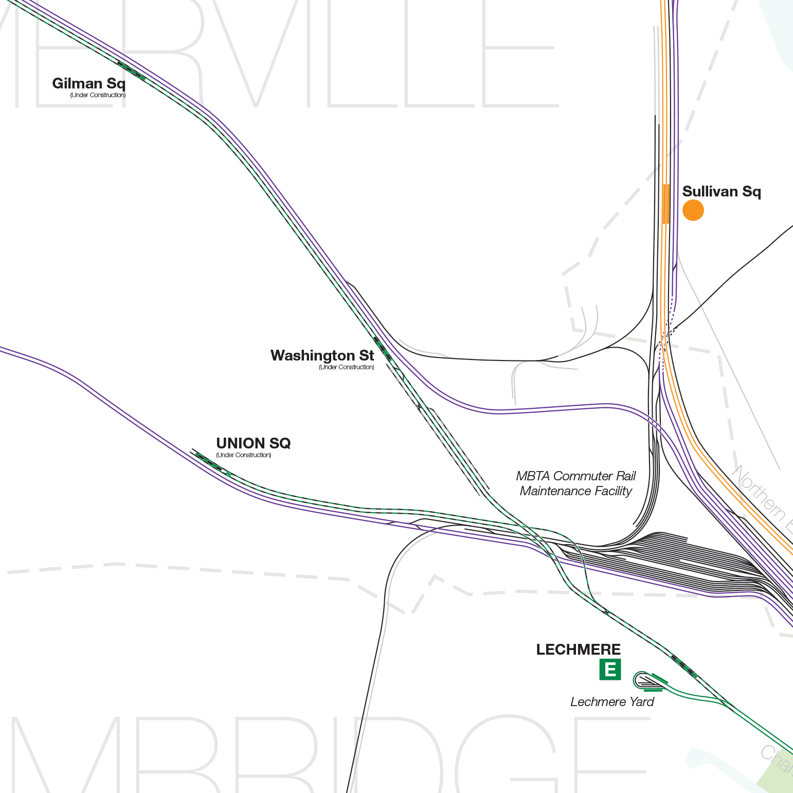
I’m happy to announce a new version of the New York City Subway Track Map and MBTA System Track Map. Both maps have lots of little detail fixes and large new additions. The MBTA Track Map now features the under construction Green Line Extension to Somerville. The New York map now features all rail (subway, commuter, and freight) in Greater New York City including the PATH and Hudson-Bergen Light Rail.

I am also working with a new, much higher quality printer and am happy to announce two sizes will be available for print. The MBTA map will be available at 36″x48″ and 42″x56″. The New York map will be available at 36″x56.5″ and 42″x66″. Prints available at my store.
As always PDFs of the maps are available for free. To make things easier I’ve added them to the website’s side menu.