Boston Historic “T” Track Map A detailed look at ever official plan to expand the T since 1897. Continue reading “Boston Historic “T” Track Map”…
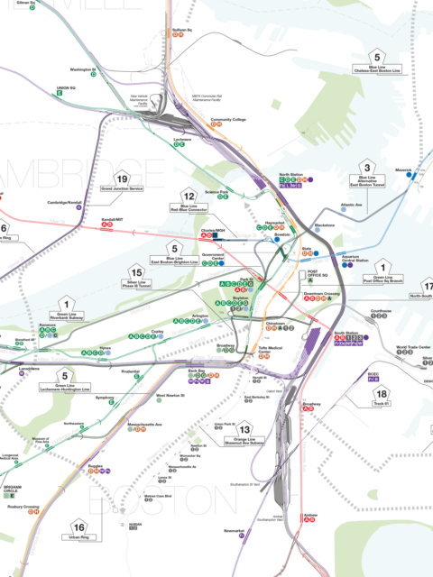
Boston MBTA: Complete and Geographically Accurate Track Map Large format prints are available at my vanmaps.com store. I was more… Continue reading “Boston MBTA: Complete and Geographically Accurate Track Map”…
An Animated History of the MBTA [UPDATE: This map was originally published in 2009. Since then, the MBTA… Continue reading “An Animated History of the MBTA”…
 vanshnookenraggenvanshnookenraggen