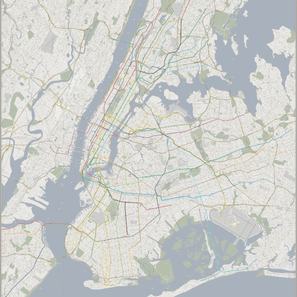
The futureNYCSubway: the vanshnookenraggen plan The Map In the drop down menu at the top of this… Continue reading “The futureNYCSubway: the vanshnookenraggen plan”…
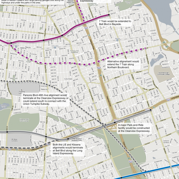
The futureNYCSubway: Queens-Flushing Trunk Line Introduction The borough of Queens came late to rapid transit development. Even… Continue reading “The futureNYCSubway: Queens-Flushing Trunk Line”…
The futureNYCSubway: 2nd Avenue Subway History The Second Ave Subway: An Introduction Ask an old time New Yorker… Continue reading “The futureNYCSubway: 2nd Avenue Subway History”…
Sunday Evening Map: Neighborhoods of Brooklyn Continue reading “Sunday Evening Map: Neighborhoods of Brooklyn”…
Personal Rapid Transit (is stupid) I’m looking at the date and it says 2010. That seems more… Continue reading “Personal Rapid Transit (is stupid)”…
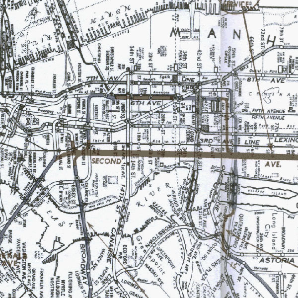
Unbuilt Robert Moses Highway Maps This is something I’ve been wanting to do for a long time… Continue reading “Unbuilt Robert Moses Highway Maps”…
The Old Elevated Subway Lines of New York City Using info from NYCSubway.org I threw together this Google Map of what… Continue reading “The Old Elevated Subway Lines of New York City”…
 vanshnookenraggenvanshnookenraggen