Client
QueensRail, Corp.
Project
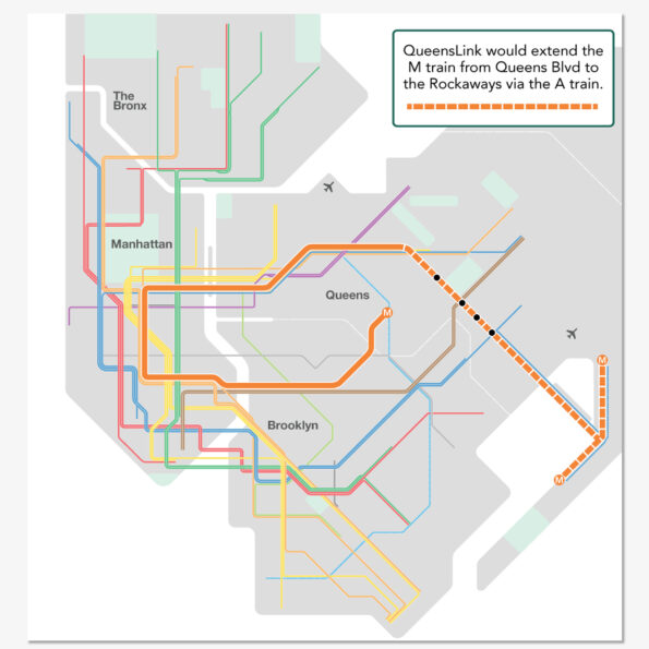
Running between Rego Park and Ozone Park in central Queens, NY, the abandoned Rockaway Beach Branch rail line has sat, growing weeds and trees, abandoned for over 60 years. The New York City Transit Authority took over the line in 1955, extending the “A” train to the peninsula. The northern section, from the LIRR Main Line to Ozone Park, was formally abandoned in 1962.
The QueensRail, Corp. is a not-for-profit that was founded to formally advocate for rail reactivation. Some early success was made when then State Assemblyman Phil Goldfelder was able to secure funding for a feasibility study.
At the same time, a counterproposal was put forth. This rails to trails linear park, called the Queensway, aimed to convert the entire abandoned right-of-way into a High Line style park, blocking any future use for transit.
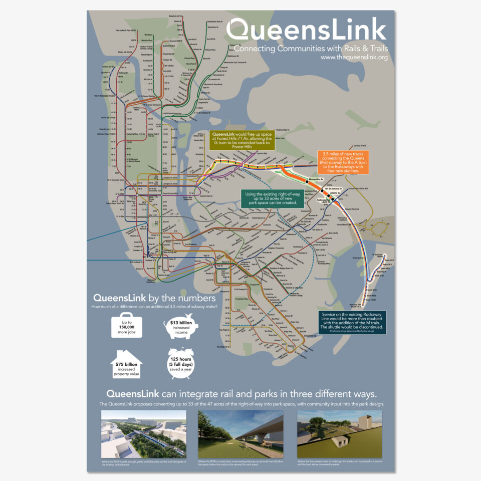
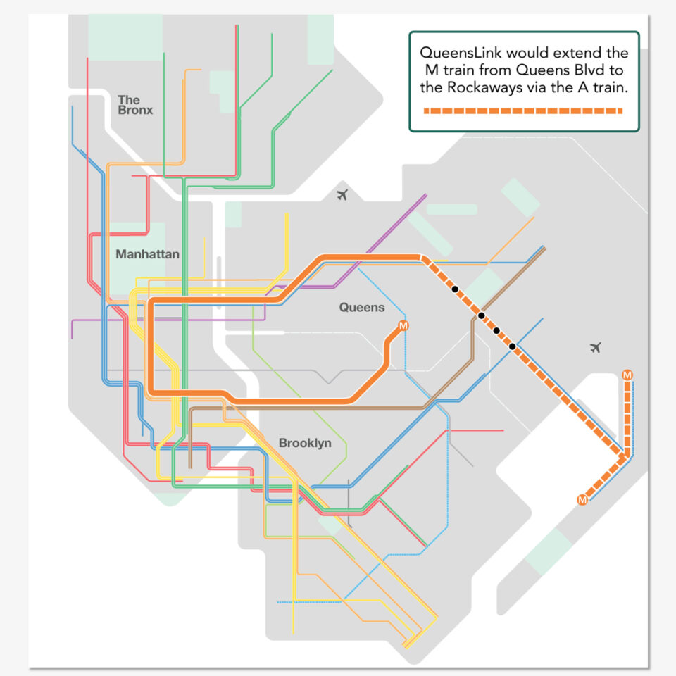
The QueensLink was born out of a collaboration between QueensRail and myself. The goal was to see if a dual rails AND trails concept was feasible. Initial surveys of the right-of-way showed that there would be enough space for both restored transit and additional park space along most, but not all, of the line. In 2019, the MTA released their feasibility report on restoring rail service and found that it was feasible, and that some of the land along the right-of-way could be used for parks.
Rebrand and Logo
A rebrand was needed to shift from something that could be seen as a potential liability to what the benefits would entail. Restoring rail along would gain the support of so-called rail fans, but wasn’t enough to galvanize the general public. What could this new connection do for riders and residents? What could connecting Queens with transit do for the average person? The name had to evolve from what the project was, to what the project could do.
The project could connect communities. In short, it would become a link. QueensLink.
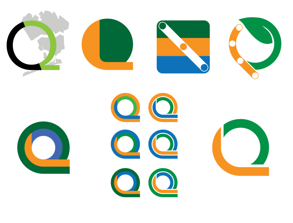
A new name required a new logo. The logo needed to represent the dual nature of the project: transit and park space. A number of design directions were considered, some abstract and some literal. The Avenir typeface was chosen for the brand, and the “Q” character was further developed into the logo. The green upper loop represents the park space, while the orange lower loop and tail represent the transit component. The orange was chosen as a mirror to the “M” train, which we were proposing extending along the rail portion of the project.

SketchUp Renderings
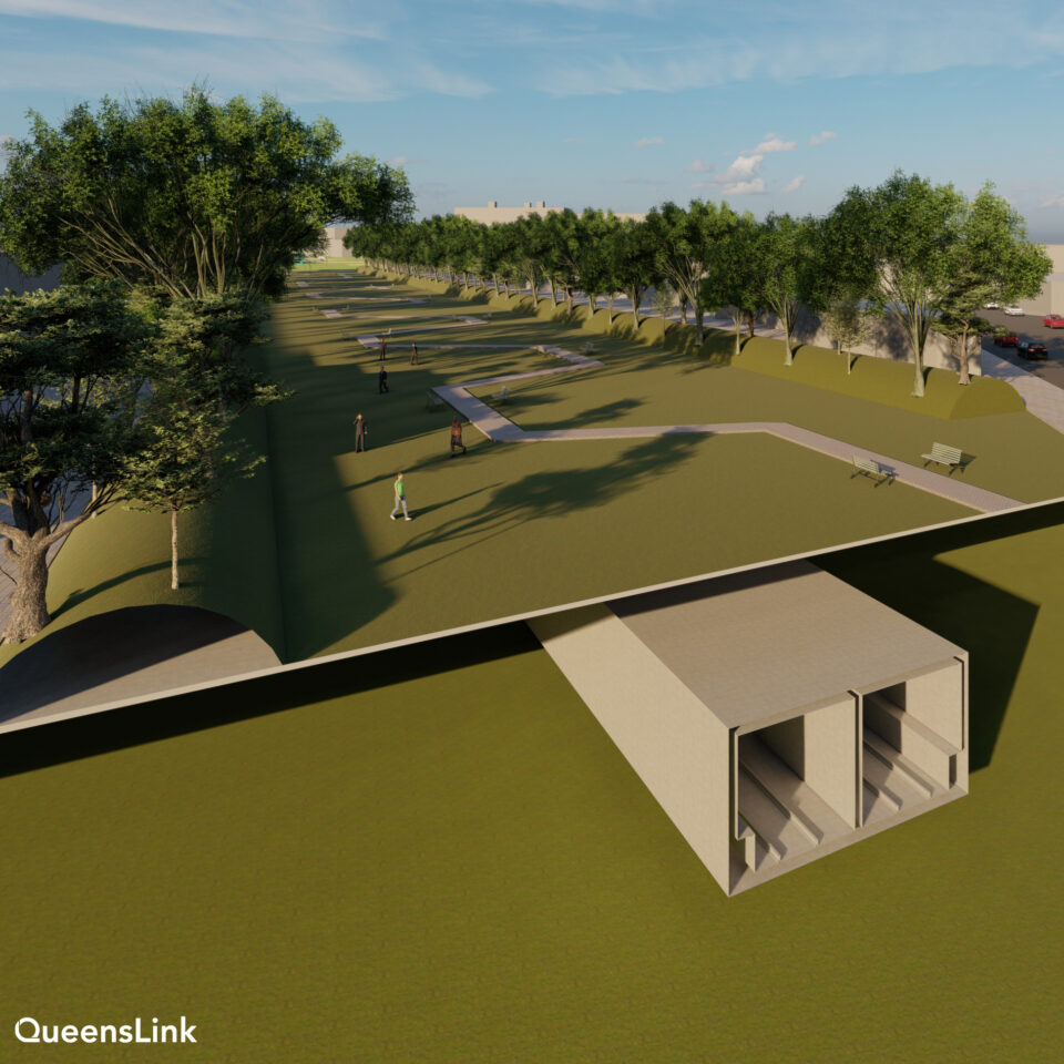
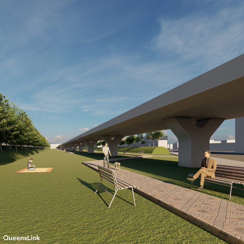
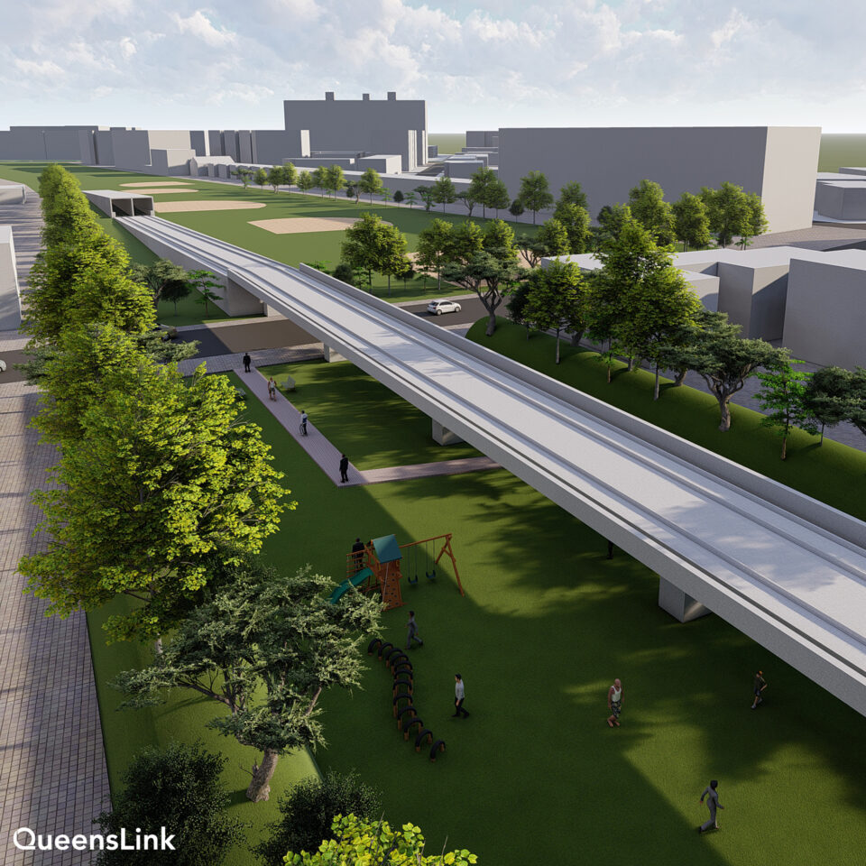
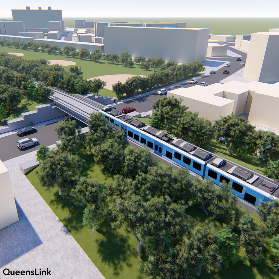
Using SketchUp, I used elevation data to recreate an area of the right-of-way located in Forest Hills, Queens. These initial renderings were focused more on proof-of-concept, showing how different elevated and tunnel elements could be incorporated into the mostly residential neighborhood.
Art Direction
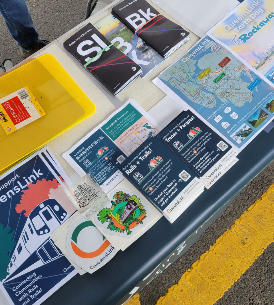
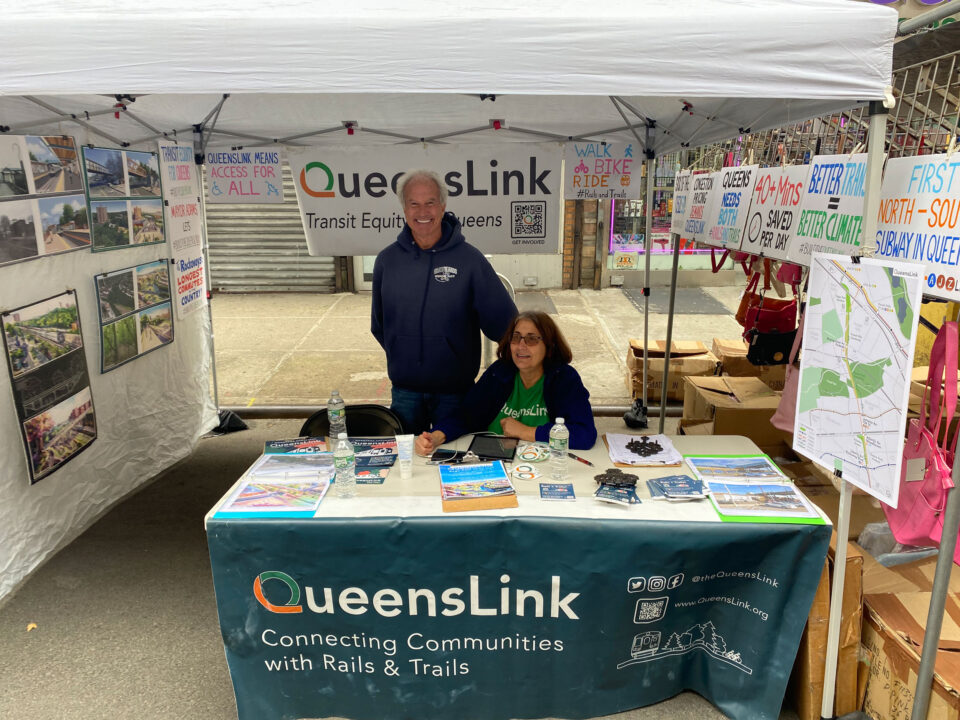
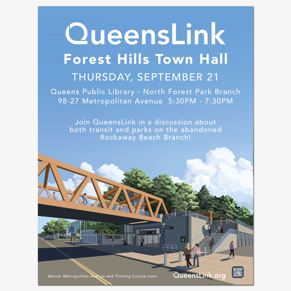
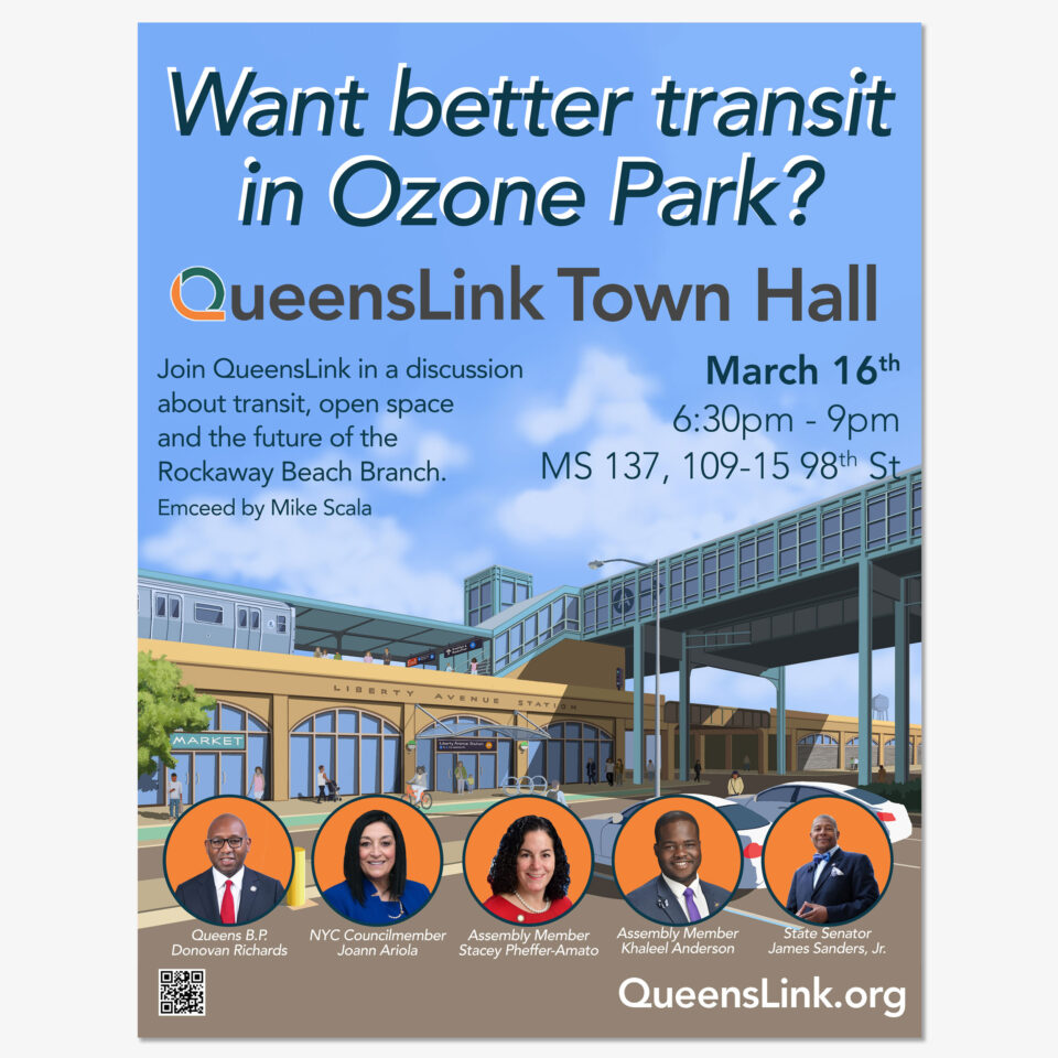
Working with my team of designers, we set out to codify our design language and create captivating renderings that would show skeptical residents how the project would work, and how we were incorporating their feedback. We also needed to expand our outreach efforts within the community. The work included:
- Developing a standard design language and color pallet.
- Creating a production schedule for new renderings.
- Walkthroughs along the entire 3.5 mile right-of-way
- We broke the project into 9 separate site plans. Each section would be analyzed, concepts developed, and rendering views chosen.
- Each designer had their own strengths and weaknesses, so renderings were divided between each designer based on the requirement of the composition.
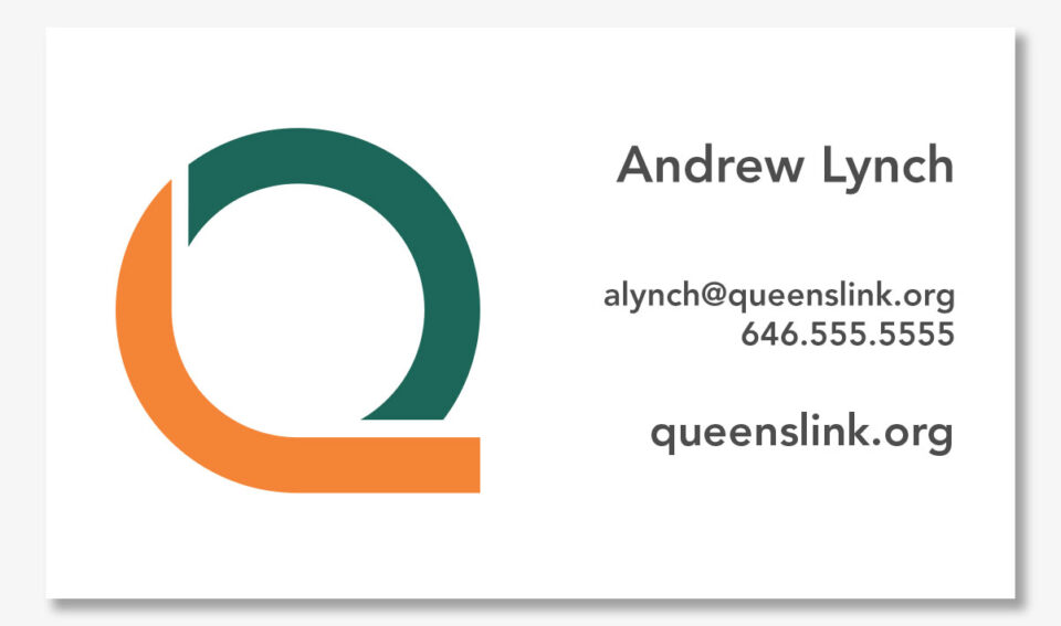
- Print material, including letterhead, banners, post cards, and posters were developed using the new renderings.
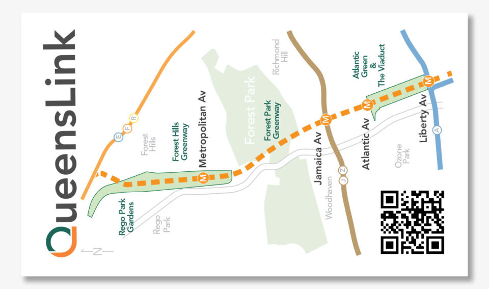
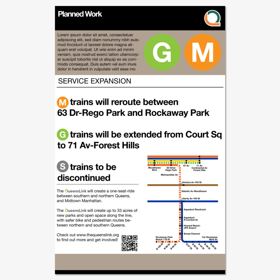
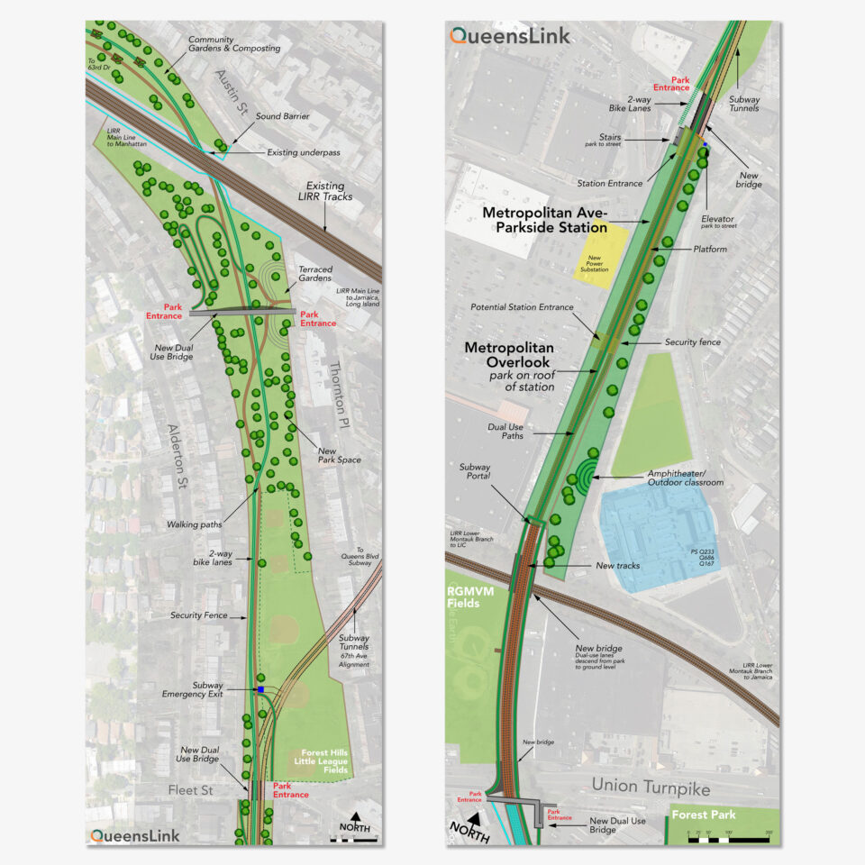
- New maps and site plans showing the proposed new service and park space were created for public feedback at events.
- Pins, buttons, and shirts were developed for publicity and fundraising efforts.
- Using the design guidelines, we created a production schedule for social media posts (Instagram, Facebook, Twitter/X).
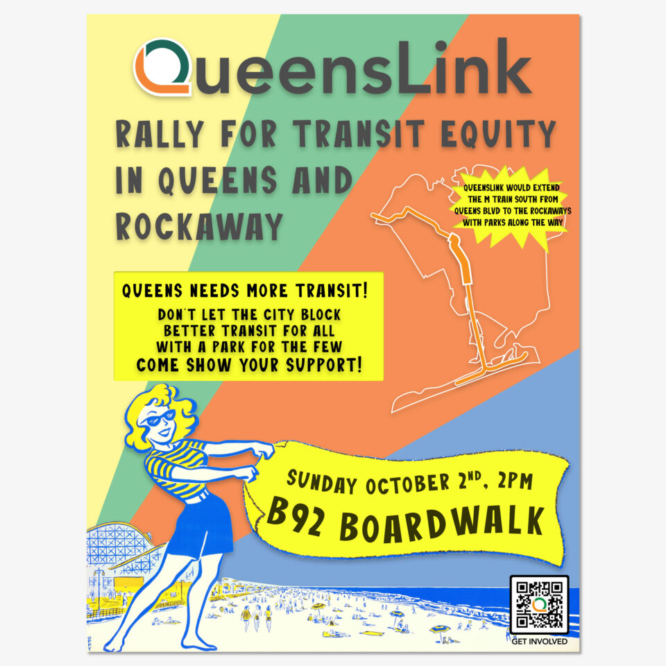
Poster Concepts
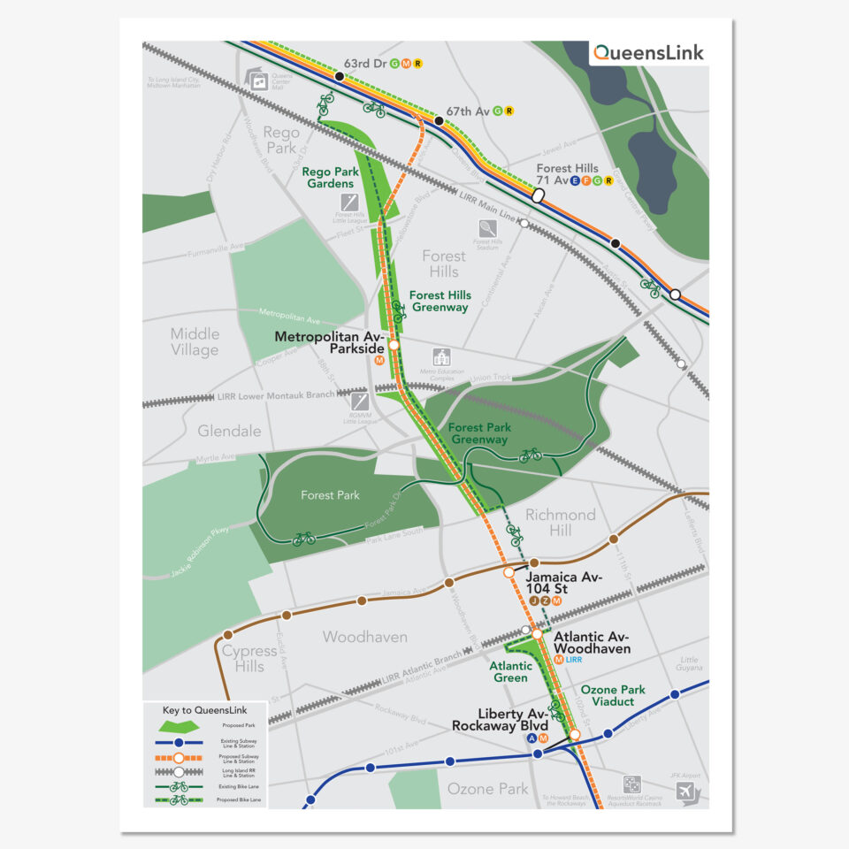
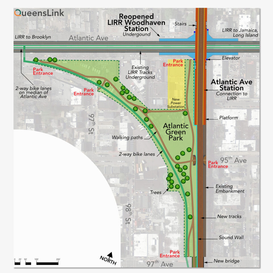
Maps
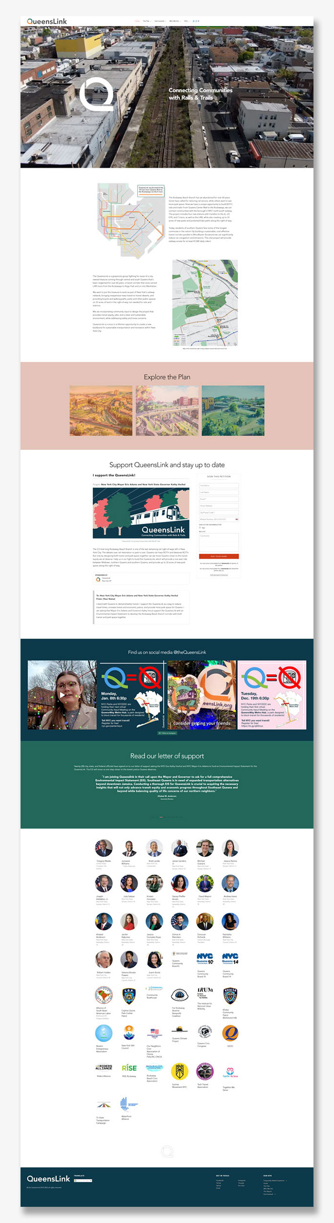
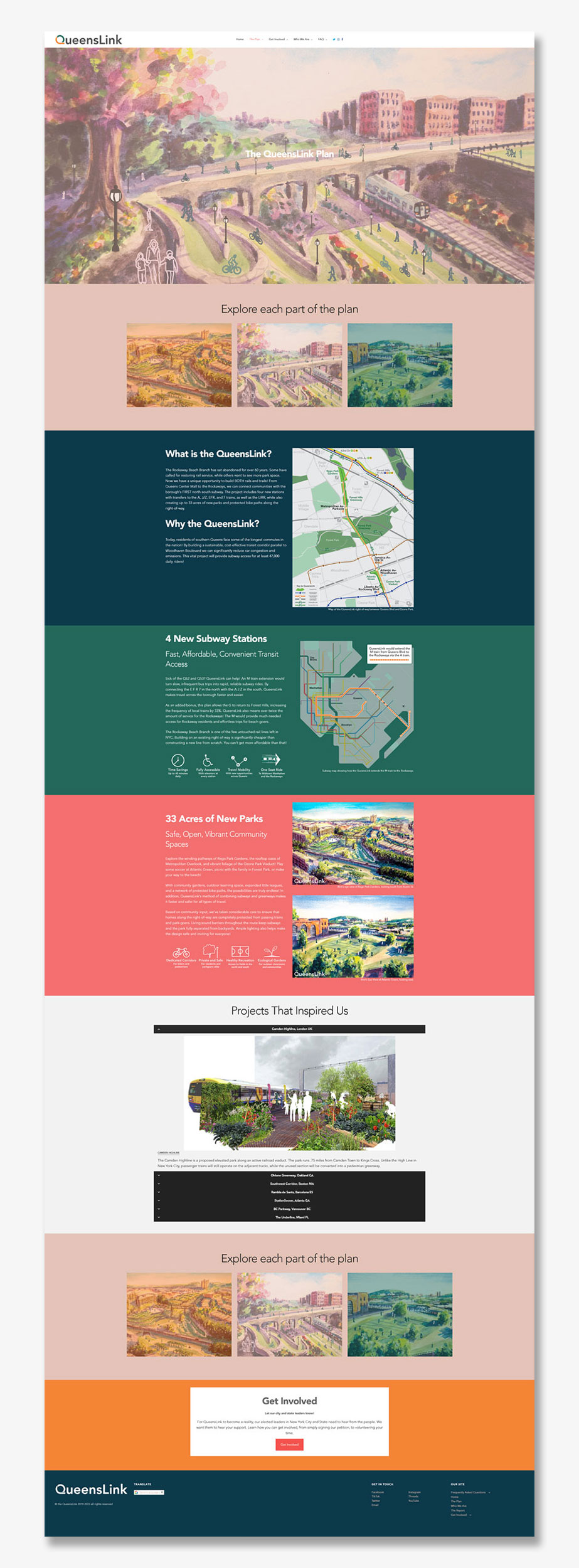
Website
The website uses the WordPress CMS with the Werkstatt Custom Portfolio Theme. Additional integration with the Action Network platform is included for non-profit engagement.