Maps – Page 4 – vanshnookenraggen

vanshnookenraggen logovanshnookenraggen

Maps – Page 4 – vanshnookenraggen

vanshnookenraggen logovanshnookenraggen
Skip to content
  • /home
  • /store
  • /biography
  • /press and podcasts
  • /track maps
  • /historic maps
  • /futureNYCSubway
  • /futureMBTA
  • /unbuilt highways
  • /urban exploration
  • /hyperreal cartography
  • /QueensLink

Archives

Categories

  • Bluesky
  • Flickr
  • Tumblr
  • Email

Category: Maps (page 4)

Chystie St Connection Poster

Celebrating 50 years of the Chrystie Street Connection

On November 27th, 1967 there was chaos on the New York City…
Continue reading “Celebrating 50 years of the Chrystie Street Connection”…

The Future of the Green Line: From Harvard and Needham to the Seaport

Boston’s subway is straining with new growth. It is time to rethink America’s oldest subway for the 21st Century.
Continue reading “The Future of the Green Line: From Harvard and Needham to the Seaport”…

The Future of the Utica Ave Subway

For future expansion of the system we need to be open to thinking outside the box. How can build the Utica Ave Subway?
Continue reading “The Future of the Utica Ave Subway”…

Philadelphia SEPTA & PATCO Vanmap Posters!

What’s your line? Just in time to see the Eagles in Super…
Continue reading “Philadelphia SEPTA & PATCO Vanmap Posters!”…

Boston MBTA: Complete and Geographically Accurate Track Map

Large format prints are available at my vanmaps.com store. I was more…
Continue reading “Boston MBTA: Complete and Geographically Accurate Track Map”…

The Future of the 2nd Avenue Subway

We are designing the world’s most expensive subway and it won’t help most New Yorkers. Here’s how we can change that.
Continue reading “The Future of the 2nd Avenue Subway”…

NYC Subway: Complete and Geographically Accurate Track Map

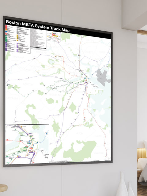
Collecting every historical map I could find, using GIS data, satellite imagery (both current and historic), YouTube videos of fan trips, my own observations looking out the window of trains through tunnels, and talking to retired track workers I was able to draw what I believe to be the most accurate track map of the NYC Subway ever.
Continue reading “NYC Subway: Complete and Geographically Accurate Track Map”…

Should there even be a One Seat Ride to the Airport?

Does NYC really need a one seat ride to its airports?
Continue reading “Should there even be a One Seat Ride to the Airport?”…

Building a better city: QueensWay vs Subway

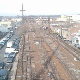
The abandoned Rockaway Branch rail road in central Queens is pitting transit advocates against the proposed QueensWay park. Both sides have their points and both sides want a better city. So why are they fighting against each other?
Continue reading “Building a better city: QueensWay vs Subway”…
Two Myrtle Ave trains merge at Myrtle Ave, one coming from Manhattan and the other from downtown Brooklyn. Photo by Frank Pfuhler via nycsubway.org

Fixing the Myrtle-Broadway Problem

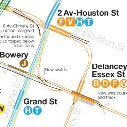
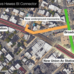
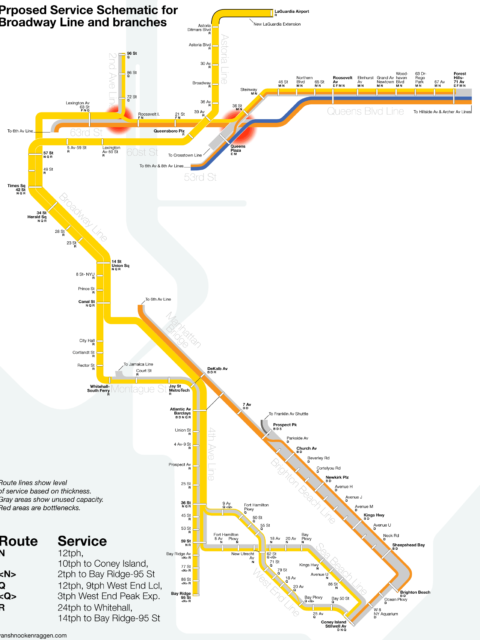
As more and more people move along the M train the limitations of the current junction at Myrtle-Broadway will soon need to be addressed. The MTA is undergoing a rebuild of the viaduct which hold the track but it will not address the bottleneck. Here’s how the MTA could do so.
Continue reading “Fixing the Myrtle-Broadway Problem”…

The L Train Shutdown: Connecting the G and J/M/Z

Due to a quirk in history there has never been a free transfer between the G train and J/M/Z trains. With the looming L train shutdown fixing this connection would go a long way in helping mitigate the disruptions.
Continue reading “The L Train Shutdown: Connecting the G and J/M/Z”…

futureNYCSubway 2016

As the major subway expansion projects of the last 15 years begin…
Continue reading “futureNYCSubway 2016”…
« 1 2 3 4 5 6 … 8 »
© 2026 vanshnookenraggen | Using Receptar WordPress theme. | Privacy Policy | Back to top ↑