
Vanshnookenraggen (van – shnuk’ – en – rag’ en) is Andrew Lynch.
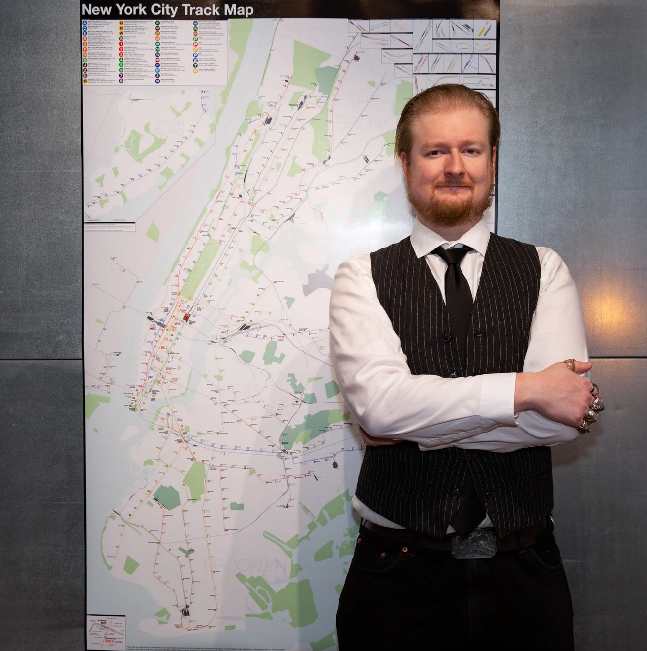
Andrew Lynch is a CUNY Hunter College Alum (’09) with a BA in Geography. He is a transit activist, photographer and cartographer living and working in New York City.
In 2019 Lynch helped create the QueensLink project, a proposal to build a subway and parkway along the abandoned Rockaway Beach Branch Railroad in central Queens.
I’ve always had an interest in cities and the built environment. Growing up in upstate New York, there were always abandoned buildings and fascinating relics to discover and explore. At the time my father worked in a rehabilitated old shirt factory on an island in the Hudson River which I would always love to explore. When I moved to Boston during the years of the Big Dig, it was a dream come true for an urban explorer; a web of tunnels and elevated roads that were under construction or being torn down. It was in Boston that I discovered photography, first as a way to document where I had been and eventually developing my eye through trial, error, and discovery.
My photography was my way of trying to see the City with my own eyes. Cities are a product of our understanding of society and as that understanding changes from generation to generation, so to do the cities we build. But cities also influence society, and it is this back and forth that makes them, to me, such interesting places. Photography is my way of understanding and documenting this relationship. Photography was my way of discovering the city when I first moved here. Now I use my talents mostly for work and the occasional urban exploration.
It was also in Boston where I first discovered my talent for making maps. Maps have always and forever will fascinate me, but it wasn’t until I realized that the maps I wanted to really see were not yet drawn that I began crafting them for myself. My maps focus on the fantasy of the almost-reality. There are plenty of fantastical buildings that have never been built, but there are also many plans for cities that have never come to fruition. My maps look at the unbuilt city of the futures-past and the potential of the future. More than with my photography, I want my maps to make people question their surroundings and their cities.
“You see things; and you say, ‘Why?’ But I dream things that never were; and I say, ‘Why not?’.
– the Serpent, Back To Methuselah
Hi Andrew, my name is Owen, I’m 10 years old. I also like maps. I draw on subway maps for fun. I really like your website and your maps (especially version 1 and version 4). I’d be really interested in making maps the way you do on your website, is there a way to contract you? Through Email? My dads Email address is [email protected] That would be the best way to contact me since I don’t see any contact information on your website. Thanks, Bye Andrew
Date 8/25/15
Hi Andrew,
I recently came across your website and was absolutely floored. It’s almost as if I was staring at the work of my alter ego, as I also have tons of ideas stuffed in my brain for both transportation and urban design but haven’t quite gotten around to getting them on paper, so to speak. I have a B.A. in Planning and Public Policy from Rutgers but after several false starts and unsuccessful endeavors in trying to get my foot into the planning field, I decided to go after my Option B, which had always been my “fantasy” job – a bus driver for NJ Transit. So when I made that decision, I made a promise to myself that I would also stay current on urban planning and transportation issues and would turn it into a hobby or side gig of sorts. As a resident of northern New Jersey and through direct experience with my job, I am well aware of the issues and problems with the current state of transportation in the region. This website has rekindled that fire and inspired me to pursue it with more vigor. I just need a couple of pointers to get started. First, what is/are the program(s) and map making software you use? Seconds, I’ve looked at some of your photographs, which are also very nice. What camera equipment do you use? I admit I am a novice when it comes to photography but I do have the desire. It’s just a matter of biting the bullet and making the time and stop being lazy! Thanks for any input.
Hi John, Glad I could inspire you so. I use a few different programs for my maps but they all start out with me sketching out lines using Google Maps. If you log into Google Maps look for “My Maps” and it will open the Google Map Engine where you can draw lines, shapes, and points on different layers giving each one a variety of different data using their data table (for what you are probably trying to do you won’t need it but it’s nice to have). The next step requires Adobe Illustrator which is an expensive and powerful graphics program. I also have some free online programs where I can find GIS data and export them into Illustrator to play around with. If you aren’t into graphics then stick with Google Maps, it’s pretty great as it is.
As for photography I really don’t shoot much anymore. I have a Canon EOS 20D which is ancient tech at this point. If you want to get into it I’d suggest not spending too much money on a fancy camera and stick to learning the basics. I see so many people out there with cameras that cost thousands of dollars but they don’t know dick about using it. Expensive things are not better, especially if you don’t know what you are doing. Good luck.
I have spent hours reviewing (and thoroughly enjoying) the revision of your New York and Boston track maps. (I’ve lived in both cities, among other places, and my earliest memories, from long before you were born, were staring out the window of the then-IND Concourse line, and watching the Polo Grounds Shuttle from the park that is now the site of the “new” Yankee Stadium.) I have one question, however– why does your wonderful creation not include the railway tracks on the west side of the Hudson. I would be eager to see the inclusion of the existing and former trackways of Amtrak, NJT, CSX, CNJ, Erie, Lackwanna and the B&O, especially along the river. Perhaps next revision? .
Hal, thanks for your comment. The answer is simple. I had to stop somewhere otherwise I’d just end up mapping the whole world. Also the dimensions are based on the printer I use and had to work with how it’s cropped.