A Tunnel Too Far, Part 1: Staten Island’s Failed Pipe Dream The first in a two-part post about the history and possible future of a subway tunnel to Staten Island. Continue reading “A Tunnel Too Far, Part 1: Staten Island’s Failed Pipe Dream”…
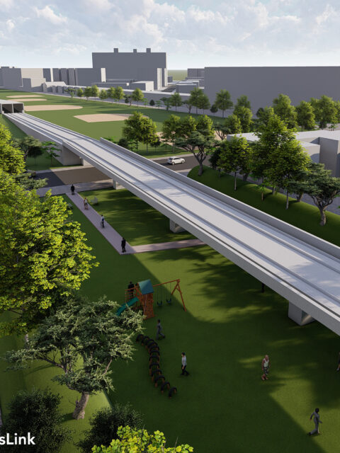
Introducing the QueensLink Those who follows me on Twitter (where I am far more active… Continue reading “Introducing the QueensLink”…
Second Avenue Subway Phase 2: The case for a crosstown extension on 125th Street Guest Author: Kristian Laverick When it was originally conceived in the 1920’s,… Continue reading “Second Avenue Subway Phase 2: The case for a crosstown extension on 125th Street”…
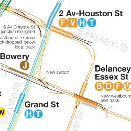
The Future of the 2nd Avenue Subway We are designing the world’s most expensive subway and it won’t help most New Yorkers. Here’s how we can change that. Continue reading “The Future of the 2nd Avenue Subway”…
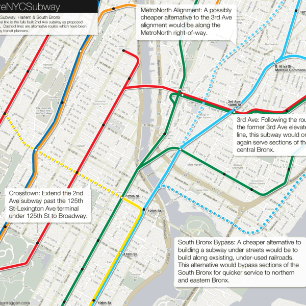
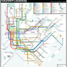
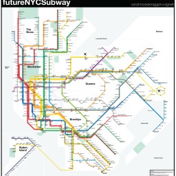
futureNYCSubway 2016 As the major subway expansion projects of the last 15 years begin… Continue reading “futureNYCSubway 2016”…
The futureNYCSubway: Manhattan-bound G Train [UPDATE] Imagine if you lived in Greenpoint and could get to Times Sq on one train? Or if you lived in Bed-Stuy and didn’t have to use the L to get home? Continue reading “The futureNYCSubway: Manhattan-bound G Train ”…
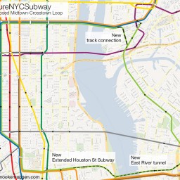
futureNYCSubway v4 Two years ago I released an update for my futureNYCSubway series. Version… Continue reading “futureNYCSubway v4”…
futureNYCSubway v3 After posting the second version of my futureNYCSubway plan last week I… Continue reading “futureNYCSubway v3”…
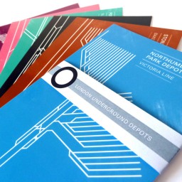
London Underground Depot Post Cards Well file this under “wish I’d thought of that”. This amazing set… Continue reading “London Underground Depot Post Cards”…
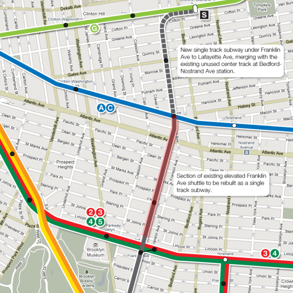
The futureNYCSubway: Franklin Ave Shuttle If the subways of New York City act as arteries pumping commuters… Continue reading “The futureNYCSubway: Franklin Ave Shuttle”…
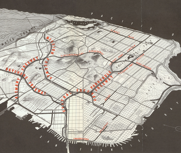
Unbuilt Highways of San Francisco A while ago, as more of a challenge to myself, I drew… Continue reading “Unbuilt Highways of San Francisco”…
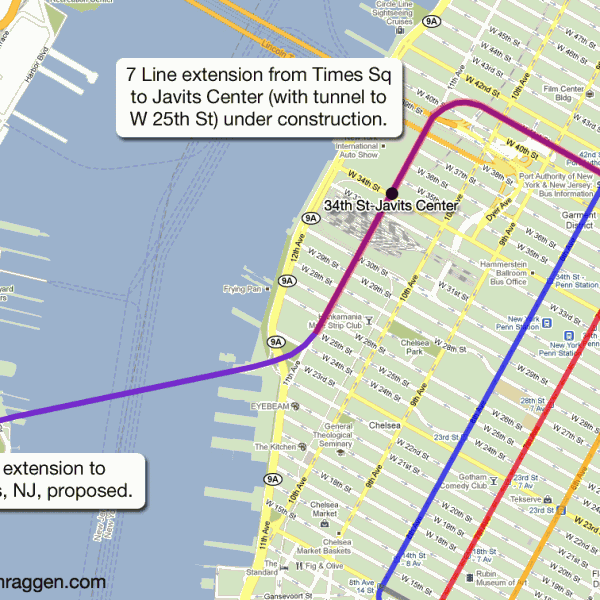
The futureNYCSubway: 7 Extension to Secaucus Like a phoenix from the ashes, the death of the ARC Tunnel… Continue reading “The futureNYCSubway: 7 Extension to Secaucus”…
 vanshnookenraggenvanshnookenraggen