Boston Historic “T” Track Map A detailed look at ever official plan to expand the T since 1897. Continue reading “Boston Historic “T” Track Map”…
IND Second System Track Map A detailed look at every official subway expansion proposal from 1929 until the present. Continue reading “IND Second System Track Map”…
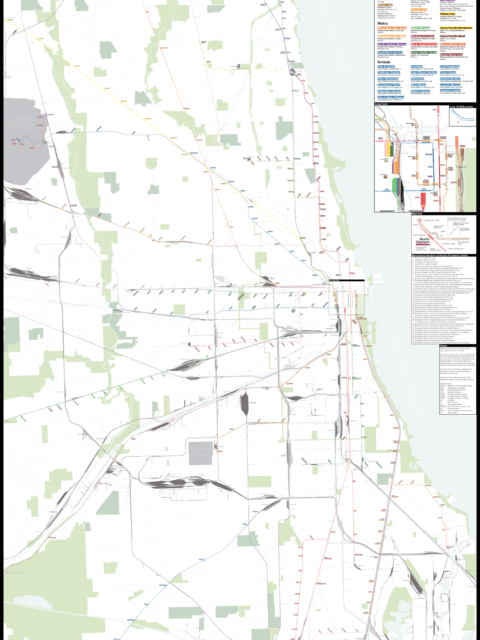
Chicago: Complete and Geographically Accurate Track Map I am incredibly excited to release my newest map: The Complete and… Continue reading “Chicago: Complete and Geographically Accurate Track Map”…
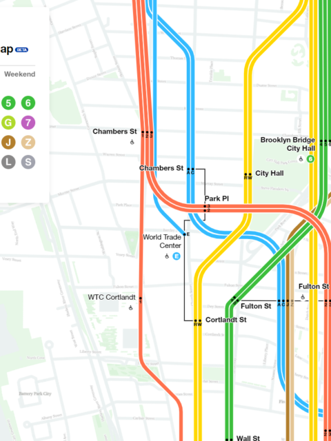
Worst. Map. Ever. The MTA stepped in the right direction with its new interactive subway map. But it also stepped in shit. Continue reading “Worst. Map. Ever.”…
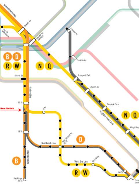
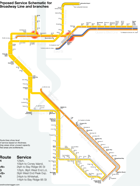
Deinterlining with One Switch Deinterlining the Broadway and 6th Ave Lines might not need a subway extension to LaGuardia Airport and can be done quickly and cheaply. Continue reading “Deinterlining with One Switch”…
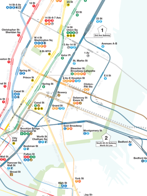
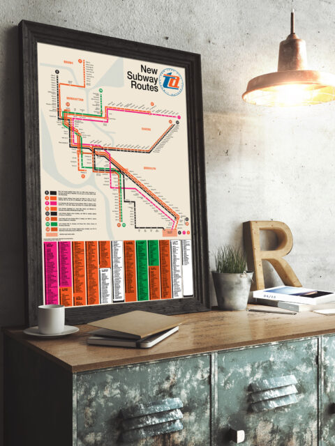
Updated NYC and Boston Track Maps I’m happy to announce a new version of the New York City… Continue reading “Updated NYC and Boston Track Maps”…
The R Train, LaGuardia Airport, and the Ripple Effect in Transit When it comes to the new LaGuardia AirTrain officials have lost sight of the larger picture. Extending the subway instead would have a system wide benefit. Here’s how. Continue reading “The R Train, LaGuardia Airport, and the Ripple Effect in Transit”…
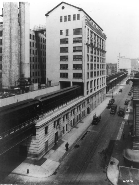
Celebrating 50 years of the Chrystie Street Connection On November 27th, 1967 there was chaos on the New York City… Continue reading “Celebrating 50 years of the Chrystie Street Connection”…
The Future of the Green Line: From Harvard and Needham to the Seaport Boston’s subway is straining with new growth. It is time to rethink America’s oldest subway for the 21st Century. Continue reading “The Future of the Green Line: From Harvard and Needham to the Seaport”…
The Future of the Utica Ave Subway For future expansion of the system we need to be open to thinking outside the box. How can build the Utica Ave Subway? Continue reading “The Future of the Utica Ave Subway”…
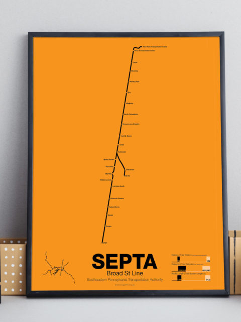
Philadelphia SEPTA & PATCO Vanmap Posters! What’s your line? Just in time to see the Eagles in Super… Continue reading “Philadelphia SEPTA & PATCO Vanmap Posters!”…
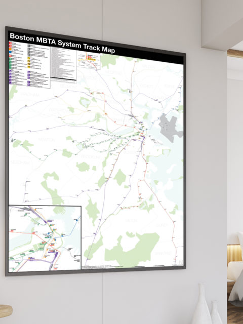
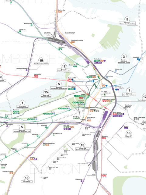
Boston MBTA: Complete and Geographically Accurate Track Map Large format prints are available at my vanmaps.com store. I was more… Continue reading “Boston MBTA: Complete and Geographically Accurate Track Map”…
 vanshnookenraggen